America's Great Lakes experience lowest ice Coverage in at least 50 years

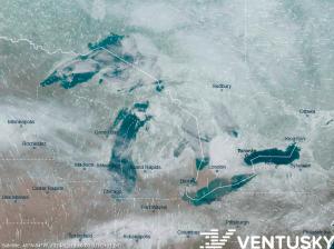
Satellite image of the Great Lakes from February 19, 2024 - over 95% of the lakes' surface is ice-free.
Unveiling a winter anomaly: The Great Lakes shatter 50-year records with startlingly low ice levels amid a surge of warm weather, sparking environmental alarms.
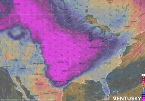
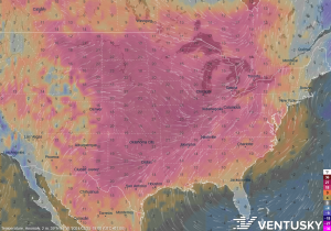
PRAGUE, CZECHIA, February 20, 2024 /EINPresswire.com/ -- North America, especially along the border between Canada and the United States, is experiencing an unusually warm winter. This warmth has significantly affected the ice cover on the Great Lakes. In recent days, from February 8 to 18, the ice extent across all the lakes reached a record low for these dates compared to data available since 1973 based on NOAA. The total average ice coverage, which has hovered around 4% in the last few days, is approximately ten times lower than the long-term average for the latter half of February. Currently, Lake Huron has the most significant ice coverage at 13%, followed by Lake Michigan at 6%. Lake Superior reports only 3%, Lake Ontario 2%, and Lake Erie barely half a percent.The reason for this season's record low ice extent is the very warm weather in recent days and weeks. Since the beginning of winter, this period has often been the warmest on record for the Great Lakes region or ranked second or third since observations began over 130 years ago. A roughly ten-day cooling period in mid-January did bring significantly below-average temperatures (with Chicago recording a maximum temperature on January 15 that was 29°C lower than the long-term average), but it was not intense enough to allow for a significant increase in ice coverage. The greatest ice extent was recorded on January 22, covering 18% of the lakes' surface.
However, exceptionally warm weather in February raised the water temperature in most of the lakes to record highs for this time of year. The outlook for the rest of the winter suggests a continuation of predominantly much warmer-than-average weather, possibly with the exception of a brief cooldown this weekend, reports Ventusky weather service. In other words, it's unlikely that the 18% ice coverage maximum will be surpassed, potentially marking the fourth lowest seasonal maximum in history. The number of days with less than 5% ice coverage is expected to reach a new high this year.
The reduced ice coverage has several negative impacts. Most notably, the erosive action of waves along the coastlines lasts longer, dramatically evident during severe winter storms. The lack of ice also allows for higher evaporation rates, decreasing lake water levels and potentially leading to stronger and more frequent occurrences of the lake effect, where coastal areas experience greater snowfall. On the other hand, a positive aspect of reduced ice coverage is the extension of the shipping season. From a long-term perspective, the current situation fits into the broader trend of the Great Lakes being among the fastest warming lakes globally.
However, not all regions are experiencing such a warm winter. In Northern Europe, particularly Scandinavia, temperatures have been significantly below average since the autumn months. For example, Finland had the largest negative temperature deviation of all countries in January. The prolonged cold weather, occasionally interrupted by warmer air from the Atlantic, led to extensive ice formation in the Bothnian Bay between Sweden and Finland, the largest in several years. The coming days are expected to bring warmer-than-average temperatures to this part of Europe.
David Prantl
Ventusky.com
email us here
Visit us on social media:
Facebook
Twitter
LinkedIn
Instagram
YouTube
EIN Presswire does not exercise editorial control over third-party content provided, uploaded, published, or distributed by users of EIN Presswire. We are a distributor, not a publisher, of 3rd party content. Such content may contain the views, opinions, statements, offers, and other material of the respective users, suppliers, participants, or authors.


